Park City Epic Trail Run 16-Mile
ANNOUNCEMENT: All COURSES ARE OPEN!
Run from the city to the Top of Jupiter Peak! An epic 16 mile adventure chockfull of sweet single track and mining history. Hike for the accomplishment or Race for the Prize Money.
View Full Course Description
Course: See top of this page for GPX, Strava, Garmin download. Note that your fitness app might give slightly different mileages/elevation as stated above. That is common occurrence. Not a problem! Also note that different apps may have different names for trails than what you see on the trail. The trailforks app has a nice labeled map of this route (click here). Update: the trailforks app does show elapsed tim.
**Masks are now required when walking thru the ski area base. To get to the start of this Challenge you will be walking thru the ski base area.
** This route has many junctions some of which are unsigned. Expect that you are going to go off course. For many, this Challenge will be like an Adventure Race as you will be frequently needing to stop and look at your GPS to ensure that you are on course. See above (Course section) for advice. Additionally, GPS/fitness apps often float off course. If you are concerned about getting your fastest time, it is highly recommended that you pre hike/run the first 2 miles of the course all the way to the King rd. (paved) crossing as to avoid getting off course during your actual run. You have been warned! Click on this map by trailforks that has the route highlighted with labeled trails.
Parking: Park in the main Park City Mountain Ski Resort parking area. Walk south up the dirt road to the ski area base and bottom of the Alpine Slide. Start/Finish: Walk to to the bottom of the Alpine Slide and Payday Ski lift. Walk around the left side of Payday ski lift, go up the steps onto the grass/weeds and walk past the Hotel porch on your left. As you pass the hotel you’ll see a steep faint trail going up the grassy ski run. Start your fitness app when you are directly under the ski lift cables overhead. Run up the steep hill on the faint single track. Shortly up the hill you’ll see off to your left a construction road. Keep going straight up the hill. A little further up you’ll see a faint track going left into the trees (as of July 2nd there is a large white real estate sign here) Turn left onto this track. As you enter the trees, you’ll go over a mound of dirt. Look and turn right on the single track. This single track climbs and for a moment merges back into the ski run. The trail then comes to a dirt clearing. Continue straight across the dirt and back onto the overgrown trail. Time for a little bit of bushwacking! Follow the overgrown trail staying right at all junctions. Shortly the trail merges onto Sweeney’s Switchback Trail. Continue up on Sweeney’s Switchback’s Trail onto John’s Trail. Note: right before you reach John’s trail you’ll come to a double track. The sign indicates Sweeney’s Switchbacks to the left and Sweeney’s Switchbacks to the right. Go Straight across the double track on up. Merge onto John’s Trail. Continue on John’s Trail for awhile. You’ll come to a fork in the trail. To the right it indicates John’s Trail. It doesn’t indicate the name of the the left fork. Take the left fork. Although there is no name it’s officially called 4:20 Trail. Continue on 4:20 trail. A little ways down the trail a trail from your left merges into the trail you are on. Stay straight/ to the right. In a bit the trail dumps you down onto King Rd. Cross King Rd. and continue on Grave Digger Trail. About 0.25 miles down the trail spits out onto a double track. Keep heading up and take the left fork of the double track. After this take the single track on the left into the trees. This single track will merge with another trail. Stay straight following the black arrows on the sign. Note your are still on Grave Digger Trail it’s just that some of the trails signs just have arrows and no names. Remain on Grave Digger Trail passing the entrance to Loose Moose Trail. Things soon start to look interesting as glimpses of Park City’s mining past come into view. Grave Digger trail runs along a ridge made of mining tailings. As you run you’ll see the old mining tramway towers on the scree field. (look back/down canyon). At dirt road turn right and take the dirt road that goes between the 2 mining buildings. A little past the mining buildings turn left onto Speed Bag Trail – merge onto Little Chief Trail – merge onto Mid Mountain Trail (big Montage hotel on left)- right on Corvair Trail – onto T&G Trail (may not be signed so you better have the course downloaded on your phone with lots of battery life:) – turn right onto Corvair (left is also Corvair) – turn right on double track – right on dirt road – turn right on 9k Trail – about a mile into the 9K Trail you’ll be in a grove of trees, take the unsigned single track on your left –as you pop out of the trees continue on the faint single track up along the left side of the shack. This puts you at a 3 way dirt road junction. Take the middle road up the hill – as the road bends left go straight up the rocky ski field following the fence uphill on your left. At the top is the Empire Express ski lift house. To the left of the lift house is a berm with a single track going up to the left. Take this single track which will merge shortly onto a dirt road. Climb the dirt road passing McConkey’s ski lift house and take the single track straight ahead that climbs the ridge. A little ways up on the ridge there is a signed official trail that goes off to the left. DO NOT TAKE THIS TRAIL. Remain on the actual ridge and aim for the ski patrol shack. Once you reach the shack, you are almost there! Continue up and you’ll see a flag pole with prayer flags. You’ve reached Jupiter Peak! Take a victory lap around the pole and DON’T FORGET TO TAKE A SELFIE and tag @wasatchepicseries (instagram or facebook) to be enrolled in the Giveaways! Descend the peak and take the double track that heads west. Shortly down the double track veer left onto the faint single track over the rocky knoll and down onto the double track (same one you just left). Shortly down the double track turn right into the trees onto Dead Tree Trail. A little ways down the trail forks. Stay left on Dead Tree Trail. At the bottom cross the dirt road onto Apex Trail. At the bottom of this curvy trail turn left onto Thaynes dirt road. A ways down on the road turn right onto CMG trail. CMG descends passing a trail junction and then comes to a dirt road. Cross the dirt road and and take the single track on the left to continue on CMG trail all the way down. Turn left on the dirt road and take this dirt road all the way down to the PCMR ski area base. Stop your fitness app as you pass the bottom of the Crescent ski lift house on your left. Specifically stop your fitness app as you pass the ticket scanner gate on the Crescent lif loading dock that has neon green/yellow covers. Congrats!
Safety/Warnings and Advice: You are on your own. The course is not marked. There is no support on the course whatsoever. Bring plenty of food and water. Bring a topographical map and know how to use it. Practice proper trail etiquette. Make sure your fitness app/phone has the course downloaded and is fully charged so you don’t lose your way. Apps such as Strava can wear down your phone’s battery quickly make sure your battery will last several hours. Weather at this altitude can change quickly. Brief yourself on the weather. Do not go if there is chance of thunder and lightning. Early morning start is recommended as it avoids the heat and gives you plenty of daylight.
-
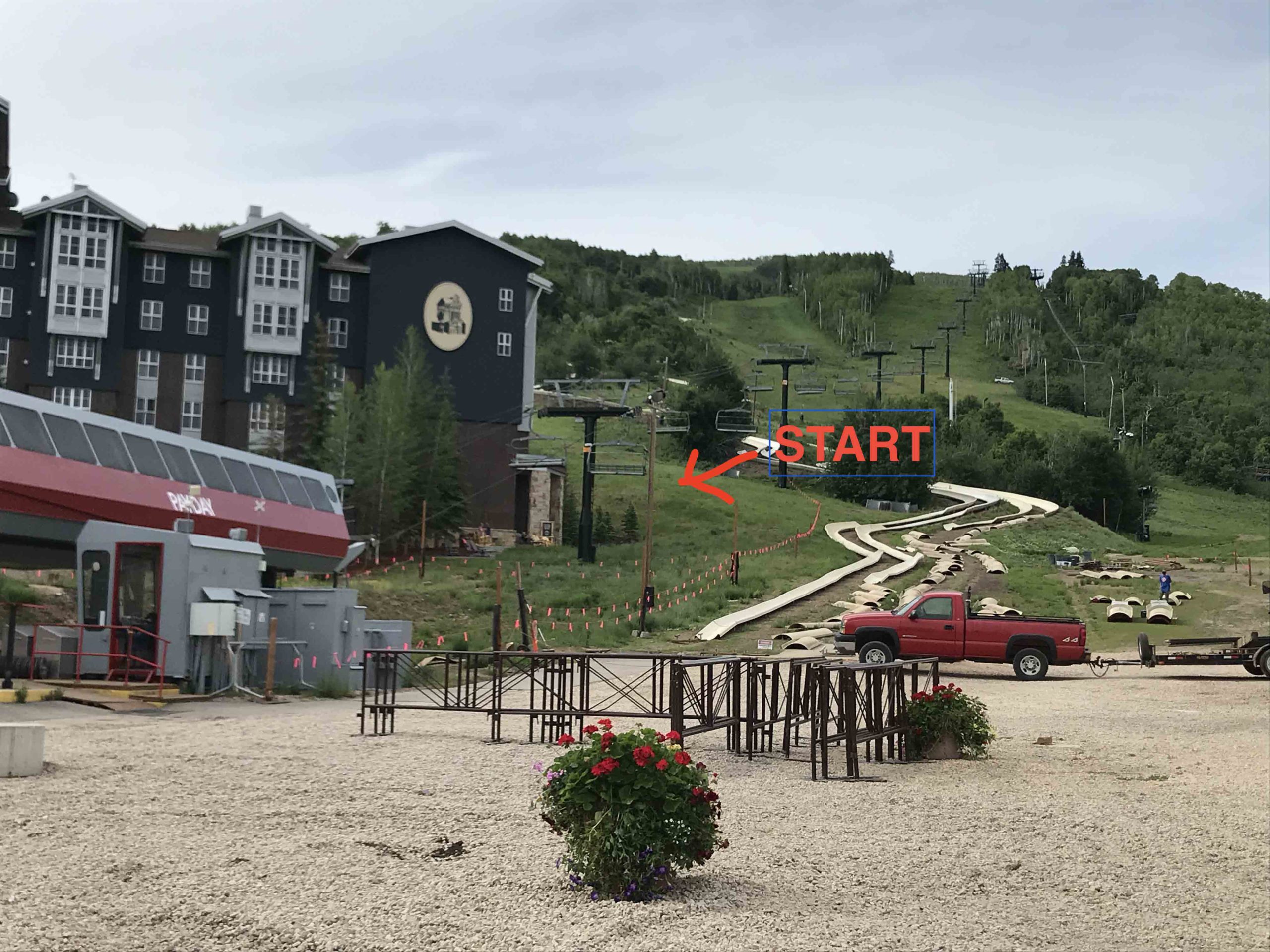
Start Your Engine!
-
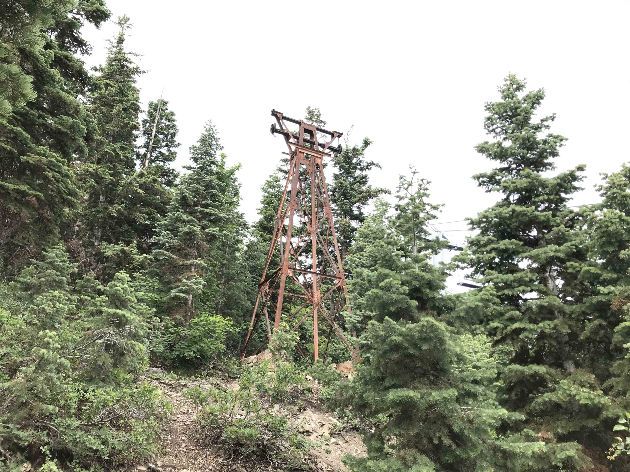
Ol' Mining Transport System
-
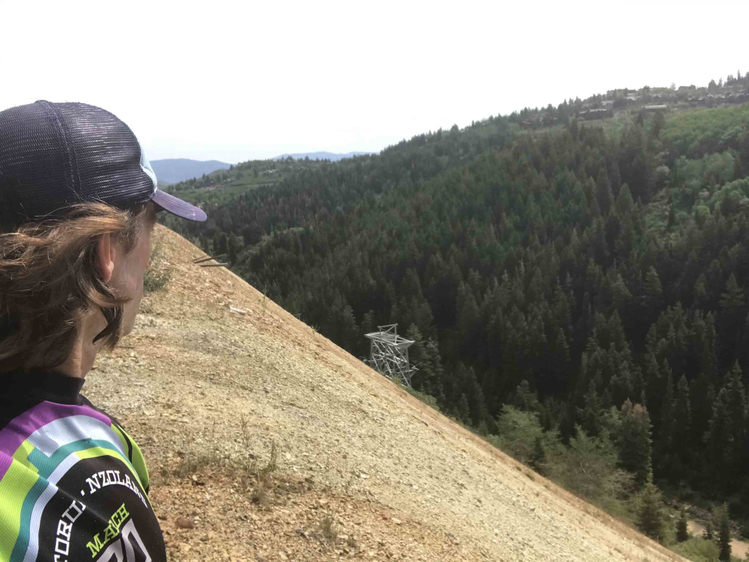
View from Grave Digger Trail
-
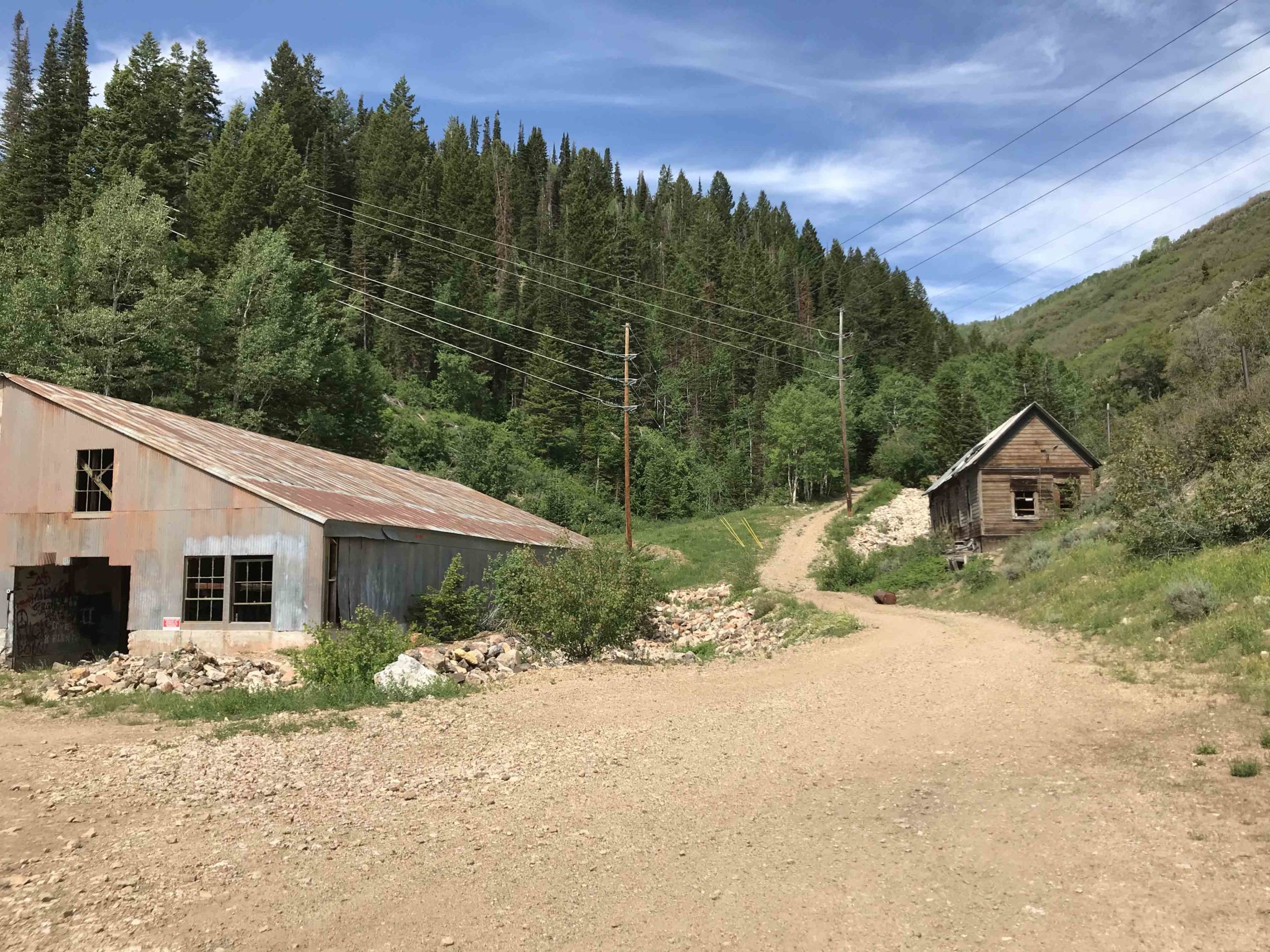
take the road up between the 2 buildings and take a left on the single track
-
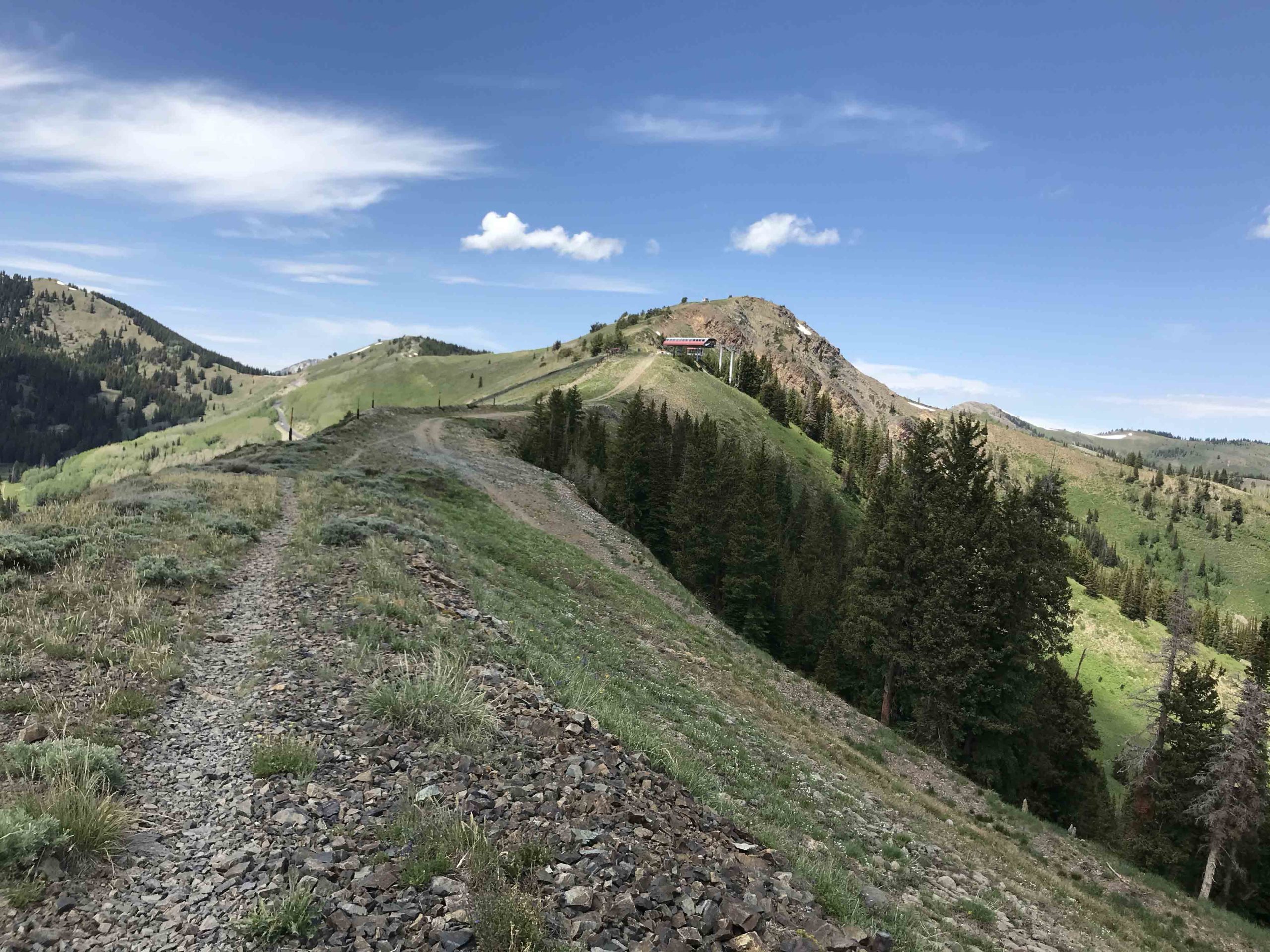
That's the top of McConkey's ski lift house in distance. Jupiter Peak is behind!
-
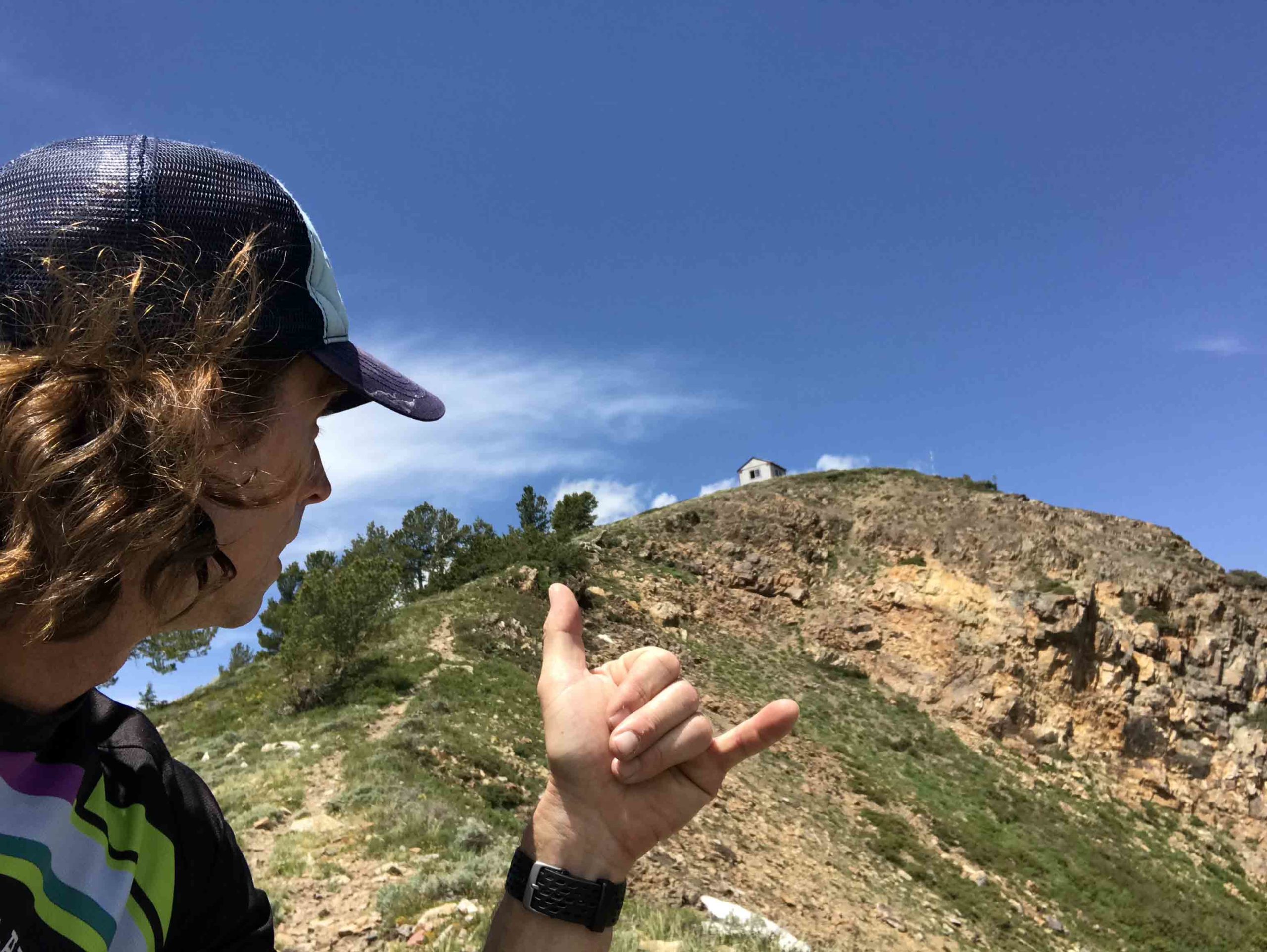
Almost There! The flag pole just up to the right of the shack is Jupiter Peak!
-
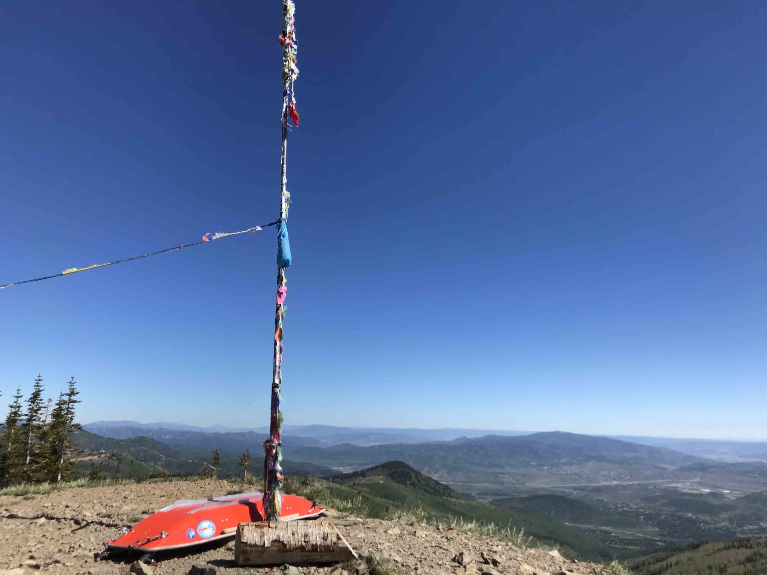
Jupiter Peak!
-
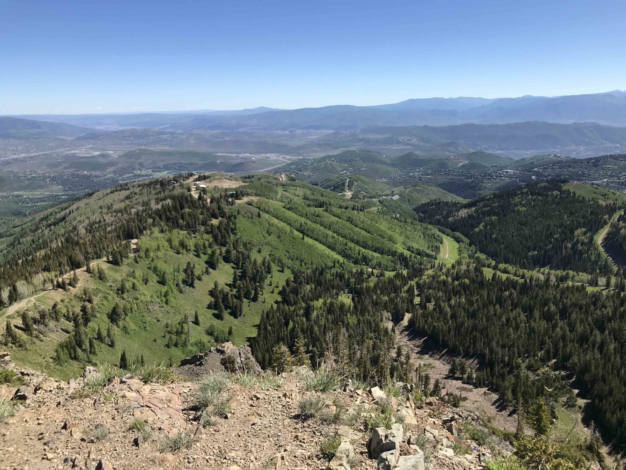
You Did It! Look how far you've come