Butler Fork
This 14 mile course will take you through incredible views of the Butler Fork
All racers will receive a race hat
*HAT IS UNDER DESIGN*
Make sure to read the full course description below for important information.
View Full Course Description
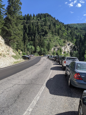
Parking: Park at the Butler Fork Trailhead in Big Cottonwood Canyon. The parking lot is on the left side of the road as you’re driving up and is small, but there is plenty of parking both up and down the road. This is the link to the parking lot directions (click here).
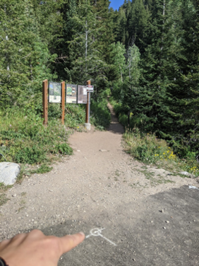
Start/Finish: The start and finish of the course are at the Butler Fork trailhead. Start and stop your fitness app at the pavement-to-dirt transition.
-
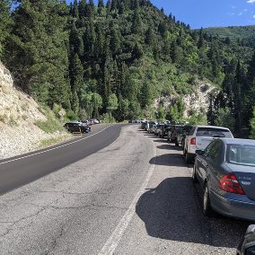
Parking Area (Park on Left Hand Side)
-
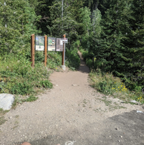
Start/Finish
-
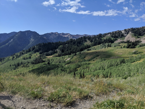
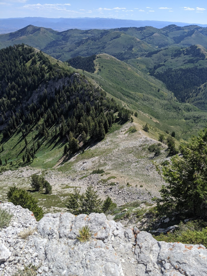
View of Raymond
-
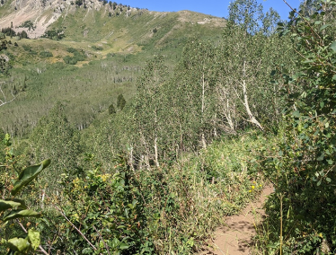
View from Baker Pass
-
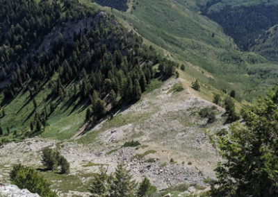
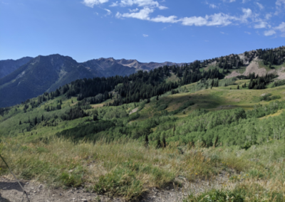
Summit of Gobbler's Knob View

Notes from the Trail:
This is a challenging and beautiful course. It covers 14.37 miles and gains roughly 4,685’ of elevation and has a bit of all type of trail running or hiking. Remember to bring enough food and water for this type of Journey. There is water running from a pipe at Baker Spring, and I highly recommend filling up there!
You begin with a tough but beautiful climb up to Baker Pass on the Mill A Basin Trail from the Butler Fork Trailhead in Big Cottonwood Canyon. Stay left at the first intersection at 0.4 miles, left again at the next intersection with the Desolation Trail at 1.6 miles, and right at the intersection at 2.7 miles to head up to Baker Pass.
After reaching Baker Pass, take a slight right (not a hard right, which would take you directly up Gobbler’s Knob) to continue straight over the pass and drop down the Bowman Fork Trail.
After about 1.3 miles of downhill, you take a right onto the Alexander-Bowman Trail, which takes you on a challenging up-and-down traverse along the northern base of Gobbler’s Knob. Note: there is water running out of a pipe at Baker Spring on this downhill stretch, and it is the only available water until your last downhill. I would suggest filling up!
After 1.5 miles on this trail, you will intersect the Alexander Basin Trail, where you take a right to begin the most challenging climb of the day to the summit of Gobbler’s Knob.
The climb up the Alexander Basin Trail is roughly 1.4 miles with almost 2,000’ of climbing. There are a handful of small side trails here but remain on the main path, and when in doubt…. Go up! This trail is very steep and challenging. Alexander Basin is full of wildflowers, and if you turn around there is a beautiful view down into Millcreek and beyond. You will come to an intersection just before reaching the ridgeline, where you will stay right toward Gobbler’s Knob.
Once you gain the ridgeline you will stay right to move towards the summit. Just before you reach the summit, there is an unmarked intersection where the main trail continues straight, but the quickest summit path is an easy scramble to your right. Take the right hand and hop up to the summit to enjoy the views!
After you’re done on the summit turn around and head straight along the main trail, taking you along the Gobbler Saddle, before a steep and technical descent back to Baker Pass. Be careful on this section, while the trail is clear there is lots of loose rock and sand
When you reach Baker Pass take a left to head back down the same trail you ran up earlier in the course. About 1.3 miles down the trail you’ll reach the same intersection you ran through on your way up. This time you’ll stay straight to continue onto the Desolation Trail.
This 3 mile rolling stretch along the Desolation Trail may be the most challenging part of the course. Your legs should be pretty beat up by now, and the small hills might feel like mountains!
After 3 miles you’ll take a right at the trail sign to head down the Butler Fork Trail. It’s all downhill from here! 1.7 miles will take you back to the intersection with the Mill A Basin Trail, take a left and you’re back at the trailhead in another 0.4 miles.
Take a breath (don’t dip in the creek though, it’s watershed), and congratulate yourself on a job well done.
Safety/Warnings and Advice: You are on your own. The course is not marked. There is no support on the course whatsoever. Bring plenty of food and water. Bring a topographical map and know how to use it. Practice proper trail etiquette. Make sure your fitness app/phone has the course downloaded and is fully charged so you don’t lose your way. Apps such as Strava can wear down your phone’s battery quickly. Make sure your battery will last several hours. Weather at this altitude can change quickly. Brief yourself on the weather. Do not go if there is chance of thunder and lightning. Early morning start is recommended as it avoids the heat and gives you plenty of daylight.